↓
 

Mobile Land Surveying

...local land surveyors in Mobile, Alabama.

Mobile Land Surveying
  • Home
  • ALTA Survey Mobile AL
  • Boundary Survey
  • Construction Survey
  • Drone LiDAR Mapping
  • Elevation Certificate | Flood Survey
    • Flood Survey
  • Land Surveying
  • Lot Survey
  • Topographic Survey
  • Mobile County, AL
    • Mobile, AL
    • Alabama Port, AL
    • Bayou La Batre, AL
    • Calvert, AL
    • Chickasaw, AL
    • Citronelle, AL
    • Creola, AL
    • Dauphin Island, AL
    • Eight Mile, AL
    • Grand Bay, AL
    • Mount Vernon, AL
    • Prichard, AL
    • Saraland, AL
    • Satsuma, AL
    • Semmes, AL
    • Theodore, AL
    • Tillmans Corner, AL
  • Baldwin County, AL
    • Daphne, AL
    • Fairhope, AL
    • Foley, AL
    • Gulf Shores, AL
    • Bay Minette, AL
    • Bon Secour, AL
    • Elberta, AL
    • Loxley, AL
    • Magnolia Springs, AL
    • Orange Beach, AL
    • Perdido, AL
    • Perdido Beach, AL
    • Point Clear, AL
    • Robertsdale, AL
    • Silverhill, AL
    • Spanish Fort, AL
    • Summerdale, AL
  • Jackson County, MS
    • Pascagoula, MS
    • Gautier, MS
    • Moss Point, MS
    • Ocean Springs, MS
    • Vancleave, MS
  • Washington County, AL
    • Chatom, AL
    • Leroy, AL
    • McIntosh, AL
    • Millry, AL
    • St. Stephens, AL
  • Contact Us
Home 1 2 3 … 5 6 >>

Post navigation

← Older posts

Welcome to Mobile Land Surveying

Mobile Land Surveying Posted on December 9, 2017 by MobileSurveyorMarch 4, 2019

Welcome to the MobileLandSurveying.com (T Brandon Bailey, PLS) website. This site is intended to provide you with information on Land Surveying in the Mobile, AL, and Mobile County area of Alabama. If you’re looking for a Mobile Land Surveyor, you’ve come to the right site.

If you’d rather talk to someone about your land surveying needs, please call (251) 281-2081 today or better yet send us a contact form request. For more information, please continue to read

Land Surveyors are professionals who measure and make precise measurements to determine the size and boundaries of a piece of real estate.  While this is a simplistic definition, boundary surveying is one of the most common types of surveying related to home and land owners.

If you fall into the following categories, please click on the appropriate link for more information on that subject:

  1. I need to know where my property corners or property lines are. (Boundary Survey)
  2. I have a loan closing or re-finance coming up on my home in a subdivision. (Lot Survey)
  3. I need a map of my property with contour lines to show elevation differences for my architect or engineer. (Topo Survey)
  4. I’ve just been told I’m in a flood zone or I ‘ve been told I need an elevation certificate in order to obtain flood insurance or prove I don’t need it. (Flood Survey)
  5. I’m purchasing a lot/house in a recorded subdivision. (Lot Survey – See Boundary Survey)
  6. I’m purchasing a larger tract of land, acreage, that hasn’t been subdivided in the past. (Boundary Survey)
  7. I need to get some location and grades set on a construction project. (Construction Survey)
  8. I need a survey of a commercial or multi-family site that meets the ALTA Land Title Survey requirements. (ALTA Survey)

If your needs don’t fall into one of the above, don’t worry, we’ll get to the bottom of it.  CALL Brandon Bailey, PLS TODAY at (251) 281-2081 or better yet send us a contact form request to discuss your survey needs.

mobile land surveying

Posted in blog, land surveying | Tagged boundary survey, FEMA, flood map, Land Surveying, land surveyor, Land Surveyor Mobile AL, Mobile AL Land Surveyor

What Is A Land Surveyor?

Mobile Land Surveying Posted on November 28, 2017 by MobileSurveyorMarch 4, 2019

land surveyors

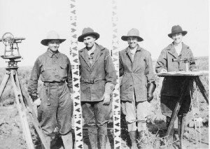
In addition to the four ladies pictured above, some very famous people in history have practiced surveying. Three surveyors and another guy are depicted on Mt. Rushmore (Presidents George Washington, Thomas Jefferson and Abraham Lincoln were all three surveyors, Teddy Roosevelt was not.) Others were Daniel Boone, Meriwether Lewis and William Clark (Lewis & Clark), Sir George Everest, Charles Mason & Jeremiah Dixon (of the Mason-Dixon Line fame) and author Henry David Thoreau practiced for a time in Concord, Massachusetts.

A land surveyor is a professional person with the academic qualifications and technical expertise to measure and plot the lengths and directions of boundary lines and the dimensions of any portion of the earth’s surface (including natural and other structures.) That definition is quite a mouthful, but in actuality the field of surveying (geomatics) includes many other facets.

For the home-owner the surveyor is the person who locates the boundary of your property and the location of your home within that boundary to determine if there are any encroachments by your neighbors onto you or vice versa. Common encroachments are fences, driveways, etc.

These days land surveyors in the United States are regulated and licensed by the various state governments. In Alabama, the Alabama State Board of Licensure for Professional Engineers and Land Surveyors was established in 1935 to protect the public by helping “to safeguard life, health, and property, and to promote the public welfare by providing for the licensing and regulation of persons in the practices of engineering and land surveying. This purpose is achieved through the establishment of minimum qualifications for entry into the professions of engineering and land surveying, through the adoption of rules defining and delineating unlawful or unethical conduct, and through swift and effective discipline for those individuals or entities who violate the applicable laws or rules.”

As of 2007, newly licensed surveyors are required to have a four year degree in surveying or a closely related field and an additional four to eight years of on-the-job training under a licensed surveyor. Licensed Land Surveyors are also required to attend 15 hours of continuing education each year to maintain and update their professional knowledge and skills.

In preparation for a typical lot or mortgage survey of your house, a surveyor may review tax maps, aerial maps, deeds, subdivision plats, zoning ordinances, subdivision regulations and possibly flood maps. For a typical lot survey the subdivision plat is the most important of these because it gives the exact dimensions of your lot and the relative location of your property corners. The surveyor uses this to locate and/or re-establish your property corners.

In the field the survey crew will search for your property corners along with some of your neighbors corners if yours can’t be found, measure the distances and angles between all of the points, locate the improvements on your property, including your house, pool, out-buildings, retaining walls, fences, driveways and sidewalks, etc. Other improvements like sanitary sewer mains, storm drainage ways, overhead power lines and the like are located because these might indicate an easement across the property. The plat should show these, but may not in all cases.

Once all of the field information is gathered, the crew chief takes the field notes and prepares a preliminary sketch of the work. This is passed along to a draftsperson who prepares the final drawing for your use. The draftsperson will check all of the maps mentioned earlier to make sure that all building setback lines and easements are shown on the drawing. The surveyed distances and directions are compared to the plat distances and directions also. Any discrepancies or encroachments are shown on the drawing. Your attorney uses the drawing to determine if any other legal work is needed during the closing. The mortgage company or bank uses the survey to insure they are loaning you money on the correct property.

So now, what do you have for your money. You have a drawing which shows your house on your lot. You should have stakes and/or flagging by all of your property corners. Make sure you know where they are located. The actual corner is marked by an iron pin or pipe of some sort. (The type of monument should be shown on your survey drawing.) You might also want to take a look for them at least once a year to make sure they’re still there. (Even animals mark their territory more often than that.)

For more specific information about what type survey you need, please contact Brandon Bailey, PLS at (205) 281-2081 or fill in our Contact form to the right of this page.

Posted in blog, land surveying, land surveyor | Tagged boundary survey, land survey, Land Surveying, land surveyor, surveyor

Land Surveyor: Famous Land Disputes All Over the World

Mobile Land Surveying Posted on October 21, 2017 by MobileSurveyorMarch 4, 2019

land surveyorA land surveyor may not be recognized as much as a doctor or a lawyer, but no one can dispute that they play a very crucial role on Earth. As proof, several countries all over the world have unsettled land disputes over other countries. Some may have been settled through the International Court of Justice, Treaty conditions, or a claimant country’s sovereignty has been recognized. And of course, these were all settled with the help of a land surveyor.

Let’s take a look at some of the famous land disputes all over the world settle by a land surveyor:

  • Mayotte (Africa) – Claimants are France and Comoros. France gained full control under the 2009 referendum, the population supported becoming an overseas department of France, and so became one on March 31, 2011.
  • Ligitan and Sipadan (Asia) – Claimants are Malaysia and Indonesia. The 2002 International Court of Justice ruling awarded both islands to Malaysia, but left unsettled the maritime boundary immediately southwest and west of the islands between Malaysia and Indonesia.
  • Eastern coast of Narva and Petseri County (Europe) – Claimants are Russia and Estonia.Russia recognized them as a part of Estonia with Treaty of Tartu, 1920. After the fall of the Soviet Union, Russia continued administering it.
  • Tuzla Island and Strait of Kerch; Sarych (Europe) – Claimants are Ukraine and Russia. The conflict arose in 2003 when the Russian authorities started to build a dam towards the island. Since then Ukraine established a border garrison on the island for a closer surveillance. The reason for the conflict is the fact that Tuzla island strategic location gives Ukraine full rights over the main channel in the Strait of Kerch and, thus, the access to the Sea of Azov.
  • San Andrés and Providencia (Central America/Caribbean) – Claimants are Colombia and Nicaragua. Colombia currently has full control because Honduras de facto recognises Colombian claim.
  • Los Monjes Archipelago (South America) – Claimants are Venezuela and Colombia. Velenzuela gains full control because Colombia no longer claims the islands, only the surrounding waters.

A piece of parcel is something that signifies power and resources thus many countries fight over it. If big countries have unsettled disputes over a piece of land, small land disputes also happen between siblings, husband and wife, and neighbors. Though you can’t hire a land surveyor from an International Court to settle your small land disputes, you can always hire a local land surveyor who can survey your property and resolve any encroachment claims and/or equally divide a property as mandated by law.

A land surveyor plays a very vital role in settling land disputes, big or small. If you are in a situation that you may need the expertise of a land surveyor, please contact Brandon Bailey, PLS at (205) 281-2081 or fill in our Contact form to the right of this page.

Posted in land surveying, land surveyor | Tagged famous land disputes, land disputes, land surveying mobile, land surveying mobile al, land surveyor mobile, Land Surveyor Mobile AL, mobile al land surveying, Mobile AL Land Surveyor, mobile land surveying, mobile land surveyor, world land disputes

Post navigation

← Older posts

Contact Form

    © Copyright Mobile Land Surveying
    (...a T. Brandon Bailey, PLS marketing website.)
    208 Mohawk Street
    Mobile, AL, 36606
    Phone: (251) 281-2081

    Web Development and SEO by:
    SEO Company for Professionals

    Terms of Use | Privacy Policy

    The owner of this website, USA Surveying & Engineering, LLC., provides coordination of professional land surveying and engineering services in all 50 states. The professional surveying and engineering services provided to you will be conducted by fully licensed professionals in your state.

    Privacy Policy
    ↑