↓
 

Mobile Land Surveying

...local land surveyors in Mobile, Alabama.

Mobile Land Surveying
  • Home
  • ALTA Survey Mobile AL
  • Boundary Survey
  • Construction Survey
  • Drone LiDAR Mapping
  • Elevation Certificate | Flood Survey
    • Flood Survey
  • Land Surveying
  • Lot Survey
  • Topographic Survey
  • Mobile County, AL
    • Mobile, AL
    • Alabama Port, AL
    • Bayou La Batre, AL
    • Calvert, AL
    • Chickasaw, AL
    • Citronelle, AL
    • Creola, AL
    • Dauphin Island, AL
    • Eight Mile, AL
    • Grand Bay, AL
    • Mount Vernon, AL
    • Prichard, AL
    • Saraland, AL
    • Satsuma, AL
    • Semmes, AL
    • Theodore, AL
    • Tillmans Corner, AL
  • Baldwin County, AL
    • Daphne, AL
    • Fairhope, AL
    • Foley, AL
    • Gulf Shores, AL
    • Bay Minette, AL
    • Bon Secour, AL
    • Elberta, AL
    • Loxley, AL
    • Magnolia Springs, AL
    • Orange Beach, AL
    • Perdido, AL
    • Perdido Beach, AL
    • Point Clear, AL
    • Robertsdale, AL
    • Silverhill, AL
    • Spanish Fort, AL
    • Summerdale, AL
  • Jackson County, MS
    • Pascagoula, MS
    • Gautier, MS
    • Moss Point, MS
    • Ocean Springs, MS
    • Vancleave, MS
  • Washington County, AL
    • Chatom, AL
    • Leroy, AL
    • McIntosh, AL
    • Millry, AL
    • St. Stephens, AL
  • Blog
  • Contact Us
Home→land surveying→Why a Plat of Survey Matters Before Development →Plat of survey commercial development site

Image navigation

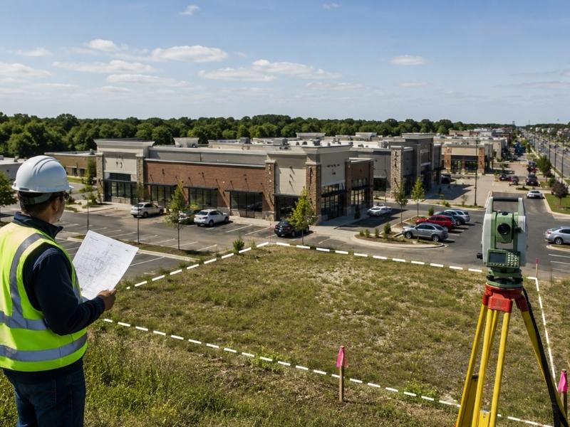
Plat of survey commercial development site

Published May 27, 2026 at 800 × 600 in Why a Plat of Survey Matters Before Development
Plat of survey layout for a commercial development site with a land surveyor reviewing property boundaries

Image navigation

Contact Form

    © Copyright Mobile Land Surveying
    (...a T. Brandon Bailey, PLS marketing website.)
    208 Mohawk Street
    Mobile, AL, 36606
    Phone: (251) 281-2081

    Web Development and SEO by:
    SEO Company for Professionals

    Terms of Use | Privacy Policy

    The owner of this website, USA Surveying & Engineering, LLC., provides coordination of professional land surveying and engineering services in all 50 states. The professional surveying and engineering services provided to you will be conducted by fully licensed professionals in your state.

    Privacy Policy
    ↑