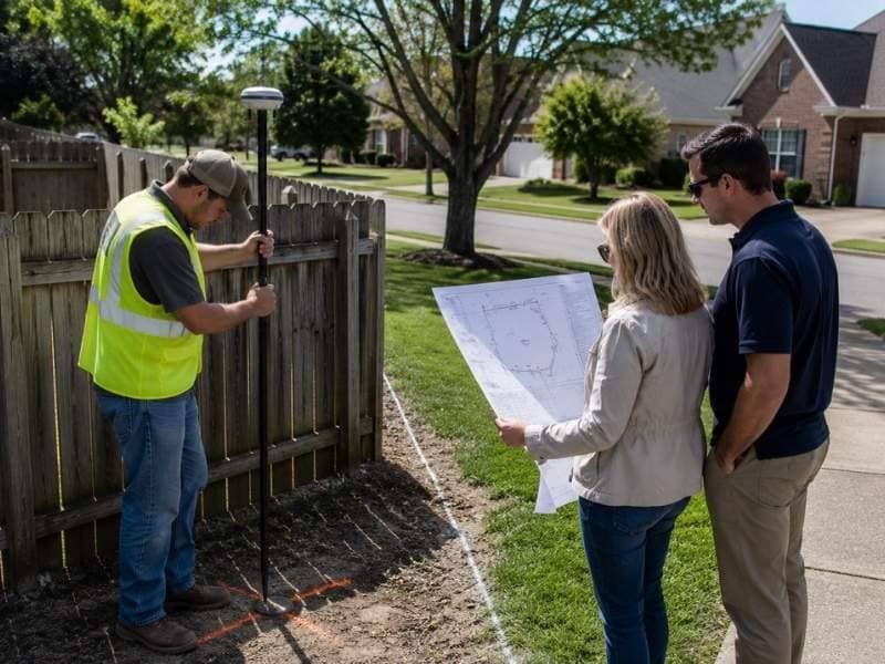
A boundary survey almost never comes back perfectly clean. Something usually turns up. A neighbor’s fence sits two feet inside the line. A driveway clips the corner. A shed straddles a setback nobody knew about. Buyers see the drawing, panic a little and assume the deal is dead.
It usually isn’t. Most survey findings get resolved, and the fixes follow a short list of well-worn paths. Knowing that list ahead of time keeps the closing on schedule.
What happens when the survey shows an encroachment?
An encroachment means something is sitting where it shouldn’t. A fence, a wall, a garage, a driveway or even a tree can cross a line. The surveyor draws it and notes it. Then the closing team decides what to do.
Four fixes come up again and again:
- The seller moves the object before closing. Cleanest option, and the most common one for small items like a fence or a shed.
- The neighbors sign a boundary line agreement. Both owners agree on where the line sits and record the document. This works well when the encroachment is old and neither side wants a fight.
- The seller grants an easement. The structure stays put, and the paperwork gives it a legal right to be there.
- The buyer accepts it. Sometimes a two-inch overhang just isn’t worth fixing, and the buyer signs off.
A fifth path exists for the ugly cases. The buyer walks. That happens when the encroachment eats a big chunk of the usable land, blocks the buyer’s plans or points to a real ownership fight.
Talk to your attorney before picking one. These are legal decisions, not survey decisions.
Why does the title company care about the survey?
Title insurance and the survey are tied together, and buyers rarely learn this until closing week.
Look at your title commitment. Almost every one includes a survey exception, meaning the policy won’t cover any problem a survey would have caught. Boundary disputes, encroachments and easements you can see on the ground all fall outside the coverage.
Deliver an acceptable survey and the title company can remove that exception. Now your policy actually covers boundary problems. Skip the survey and the exception stays, so you’re buying insurance with a hole in it exactly where the risk lives.
That’s the real reason lenders demand a survey on commercial deals and many residential ones. They want the coverage, not the drawing.
What does the surveyor’s certification actually mean?
The certification block sits in the corner of the drawing, and most buyers skim right past it. It names the people who can rely on the survey.
If the certification names the seller and their old lender from 2011, it doesn’t cover you. Your title company can refuse it. Your lender can refuse it. A survey certified to somebody else is a picture, not a document you can lean on.
So when a seller hands over an existing survey, check two things before you get excited. First, who is it certified to. Second, when was the fieldwork done. A survey certified to the right parties and reflecting current conditions can save you time and money. Anything else usually means ordering a new one.
How do you read the drawing without missing something?
A property survey map holds more information than people realize, and the important parts are easy to overlook.
Start with the boundary itself. Compare the lines and distances on the drawing against the legal description in your contract. They should match. When they don’t, ask why, because a mismatch can mean the deed describes different land than the one you’re buying.
Then look at the surveyor’s notes. These live in the margins and they carry real weight. A note might say a monument was not found, or that a fence line differs from the record line, or that a portion of the property sits in a flood zone. Nobody bolds these. You have to read them.
Finally, check what’s near the line. Structures, driveways, retaining walls, utility poles and worn paths across the grass all matter. A dirt path might mean a neighbor has been crossing your land for years, and long use can create legal claims in many states.
Who needs to see the survey before closing?
More people than most buyers expect, and each one is looking for something different.
Your title company compares the survey against the recorded easements and exceptions in the commitment. That comparison generates any survey-related objections, and those objections have a deadline.
Your lender checks whether the survey meets their requirements and whether anything on it threatens the value of their collateral.
Your attorney reads the notes, the certification and any encroachment for legal exposure.
And you should read it too. You know your plans for the property. Nobody else in the room knows that you intend to build a pool right where an easement runs.
Get it circulated the day it arrives. A survey that sits in an inbox for a week is a survey that’s about to blow up your timeline.
Frequently Asked Questions
Can a survey problem actually kill a deal?
It can, but that’s the exception rather than the rule. Small encroachments get fixed, waived or documented, and most closings absorb them without much drama. Deals fall apart when the finding is large, when it destroys the buyer’s plan for the property, or when a neighbor disputes ownership and nobody wants to litigate it.
What is a survey exception on a title commitment?
It’s a line in the policy saying the title company won’t cover problems a survey would have revealed. Encroachments, boundary conflicts and visible easements sit outside your coverage while that exception stands. Providing an acceptable survey usually lets the company delete it, which is a large part of the survey’s value.
Can I use the survey the seller already has?
Sometimes. Check who it’s certified to and how old the fieldwork is. A survey certified to a previous owner and their lender gives you no legal standing, and conditions on the property may have changed since. Your title company decides whether it’s acceptable, so send it over early and ask.
What if a neighbor disagrees with the survey?
The surveyor locates the boundary based on records and evidence, but a surveyor can’t resolve an ownership dispute. That belongs to the attorneys and, if it goes far enough, the courts. A boundary line agreement signed by both owners settles many of these without anyone going near a courthouse.
Should I read the notes on the survey?
Yes, and read them carefully. The notes tell you what the surveyor found, what they couldn’t find and what didn’t match. A missing monument, a fence off the line or a flood zone boundary will appear there and nowhere else on the drawing.