↓
JAVASCRIPT IS DISABLED. Please enable JavaScript on your browser to best view this site.
Mobile Land Surveying
Search for:
...local land surveyors in Mobile, Alabama.
Mobile Land Surveying
Home
ALTA Survey Mobile AL
Boundary Survey
Construction Survey
Drone LiDAR Mapping
Elevation Certificate | Flood Survey
Flood Survey
Land Surveying
Lot Survey
Topographic Survey
Mobile County, AL
Mobile, AL
Alabama Port, AL
Bayou La Batre, AL
Calvert, AL
Chickasaw, AL
Citronelle, AL
Creola, AL
Dauphin Island, AL
Eight Mile, AL
Grand Bay, AL
Mount Vernon, AL
Prichard, AL
Saraland, AL
Satsuma, AL
Semmes, AL
Theodore, AL
Tillmans Corner, AL
Baldwin County, AL
Daphne, AL
Fairhope, AL
Foley, AL
Gulf Shores, AL
Bay Minette, AL
Bon Secour, AL
Elberta, AL
Loxley, AL
Magnolia Springs, AL
Orange Beach, AL
Perdido, AL
Perdido Beach, AL
Point Clear, AL
Robertsdale, AL
Silverhill, AL
Spanish Fort, AL
Summerdale, AL
Jackson County, MS
Pascagoula, MS
Gautier, MS
Moss Point, MS
Ocean Springs, MS
Vancleave, MS
Washington County, AL
Chatom, AL
Leroy, AL
McIntosh, AL
Millry, AL
St. Stephens, AL
Blog
Contact Us
Home
→
blog
→
The Basics of Land Surveying
→
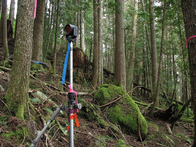
Survey Instrument
Image navigation
← Previous
Survey Instrument
Published
September 17, 2010
at
640 × 480
in
The Basics of Land Surveying
Image navigation
← Previous
↑