
How a Cadastral Surveyor Protects Your Property Rights
Property ownership looks simple on paper. You buy land, you get a deed, and the land is yours. What most developers find out too late is that a deed alone doesn’t tell the full story. Boundary lines can be wrong. Records can conflict. And without a cadastral surveyor involved, those problems tend to surface at the worst possible moment, usually during a sale, a permit application or a court proceeding.
This article explains how cadastral surveying protects your property rights and why developers who skip this step take on more risk than they realize.
What a Cadastral Survey Actually Does
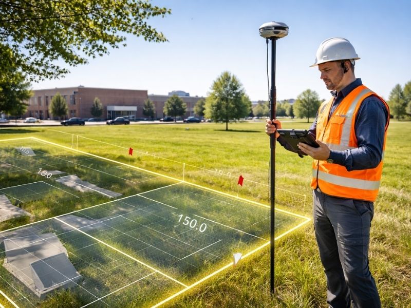
A cadastral survey establishes or re-establishes the legal boundaries of a parcel of land. It connects the physical ground to the official record. The surveyor takes the legal description in the deed and turns it into measurable, documented boundaries that can be defended in court, accepted by a title company and relied on for construction.
This goes further than a standard boundary survey. Cadastral work is tied directly to the land registration system. The boundaries determined aren’t just drawn on a map. They become part of the public record and link to the ownership chain for that parcel.
For developers, that distinction matters. A boundary survey tells you where the lines are. A cadastral survey makes those lines legally defensible.
How Deed Descriptions Create Problems Developers Don’t Expect
Most deeds describe property using metes and bounds language or references to a recorded plat. Both systems work well when the original measurements were accurate and the records are clean.
They often aren’t.
Metes and bounds descriptions written decades ago relied on physical features that no longer exist. A tree used as a reference point is gone. A creek has shifted. A monument that was set by hand is now off by several feet when measured with modern equipment.
Recorded plats have their own issues. Lots in older subdivisions sometimes have cumulative measurement errors across a block. By the time you get to the last lot on the street, the recorded dimensions and the actual ground measurements don’t match.
A cadastral surveyor researches the full chain of title, compares historical records with current field measurements and identifies where the discrepancies are. That work is what keeps a developer from building in the wrong place or buying land with a boundary problem baked in.
Where Property Rights Break Down Without Cadastral Work
Encroachments Go Undetected
An encroachment happens when a structure or improvement sits over a property line. It could be a fence, a building corner, a driveway or a retaining wall. Without a current cadastral survey, encroachments often go unnoticed until a sale or refinance triggers a title search.
At that point, the encroachment becomes a defect on the title. The seller has to resolve it before closing, which can mean legal action, a boundary agreement with the neighbor or a costly redesign. None of those are cheap or fast.
Easements Get Missed
Easements are legal rights that allow another party to use part of your property for a specific purpose. Utility companies hold them. Neighboring properties sometimes share access through them. They’re recorded in public records, but they don’t always show up clearly in a deed description.
A cadastral survey identifies recorded easements and shows exactly where they sit on the ground relative to your parcel. Developers who don’t know where an easement runs before they design a building sometimes find out during permitting. That’s a bad time to learn your planned structure sits directly over a utility right of way.
Title Insurance Has Limits
Title insurance protects buyers against certain risks, but it doesn’t cover everything. Boundary disputes that arise from a survey conducted after closing, encroachments that a survey would have caught and errors in the legal description that weren’t caught before purchase can all fall outside what the policy covers.
A cadastral survey done before closing reduces the chance of running into those gaps. It’s documentation that the boundaries were verified, not just assumed.
How a Cadastral Surveyor Supports Legal Proceedings
Property disputes sometimes move into legal territory. When they do, courts look for documented evidence of where the boundary sits and how that determination was made.
A cadastral surveyor can serve as an expert witness. Their certified findings carry weight in court because they’re based on deed research, field measurements and professional standards. A neighbor’s claim based on where they think the line is doesn’t carry the same weight.
Developers involved in acquisition disputes, easement conflicts or encroachment litigation need this kind of documentation. Getting a cadastral survey done after a dispute starts is possible, but getting one done before means you already have the evidence if something goes wrong.
What a Cadastral Survey Produces
The final product is a certified survey document that includes the boundary lines with precise measurements, the location of any monuments set or found, easements and rights of way affecting the parcel, any encroachments identified and the surveyor’s professional seal and certification.
That document gets filed with the county. It becomes part of the public record for the parcel and can be referenced in future transactions, permits and legal proceedings.
For developers, this is the kind of documentation that lenders want to see, that title companies rely on and that engineers use to position structures correctly on a site.
When Developers Should Order a Cadastral Survey
Before purchasing land with a complicated ownership history. Before starting any development project where boundary accuracy affects the design. When a neighbor challenges your boundary. When a title company flags a boundary issue during closing.
Don’t order it after the problem is already visible. By then, the survey confirms what you’re dealing with rather than helping you avoid it.
Frequently Asked Questions
What is the difference between a cadastral survey and a boundary survey?
A boundary survey locates and marks the edges of a property based on existing records. A cadastral survey goes further by connecting those boundaries to the official land registration system. The findings become part of the public record and are tied directly to legal ownership. Both involve field work, but cadastral surveys carry a stronger legal and administrative dimension.
How does a cadastral survey protect against boundary disputes?
It creates a certified, documented record of where the boundary sits based on deed research and field measurements. That record can be used in negotiations, mediation or court proceedings. Having it in place before a dispute starts puts the property owner in a much stronger position than trying to establish boundaries after a conflict has begun.
Does a cadastral survey affect title insurance?
Yes. A cadastral survey can reduce the exceptions and limitations that a title company includes in a policy. It gives the title company documented evidence that the boundaries were verified rather than assumed, which can result in broader coverage and fewer carve-outs.
Can a cadastral survey identify easements that aren’t in the deed?
A cadastral surveyor researches the full record history for a parcel, which includes recorded easements that may not be clearly described in the deed itself. The survey will show where those easements run on the ground, which is information that affects how the property can be developed.
How long does a cadastral survey take?
It varies based on the complexity of the property’s ownership history and the condition of existing monuments. A straightforward residential parcel in a well-documented subdivision may take two to three weeks. A larger parcel with a complicated chain of title or missing monuments can take longer. Ask the surveyor upfront what factors might extend the timeline for your specific property.