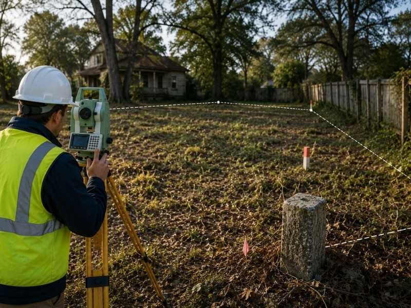
A boundary survey shows exactly where your land begins and ends. Getting one before you build protects your money and keeps your timeline on track. A surveyor measures your property lines and finds hidden restrictions that could stop your plans. Banks, insurance companies, and permit offices will ask for this information anyway. Getting a survey first means you control the process.
Why Banks Won’t Approve Loans Without One
Banks need to know your property is real and safe before they lend money. A boundary survey proves this. It shows the bank exactly what land they’re securing as collateral.
When you ask a bank for a construction loan, they want answers. Is the property exactly as the deed describes? Are there easements or other rights that limit your land? Are there boundary disputes with neighbors? A current survey answers all these questions before the bank turns down your loan application.
Banks also use surveys to figure out the true land area. If your deed says ten acres but the survey shows 9.8 acres, this changes how much money the bank will lend. A survey stops these size surprises at closing time.
If you don’t have a survey, banks will demand you get one before they approve your loan. This delays your closing and costs you money. Getting the survey first puts you in control and removes this common delay.
How Surveyors Find Hidden Restrictions That Cost You Money
Not all restrictions appear in a simple deed search. Surveyors dig into records to find easements, covenants, and old restrictions that might not show up easily. They find utility rights, drainage easements, and neighbor access rights that are legally tied to your land.
These restrictions matter because they limit what you can build. An easement through your building site might make your whole development plan impossible. A rule that says residential only blocks any commercial work. A neighbor’s right to cross your land might force you to keep a path open.
Surveyors find these restrictions by researching property records, old surveys, and deed language. They don’t just measure lines. They research the legal history of your parcel. This work stops expensive development mistakes.
Many property owners find restrictions only after they buy the land and pay for design work. A survey before you commit to a plan saves you time and money. It stops wasted costs on work you can’t actually do.
What Insurance Companies Must See Before They’ll Cover Your Project
Insurance companies check boundary information before they write policies. They need to know if your property has boundary questions, missing markers, or encroachment problems.
If your property has a history of boundary disputes, an insurance company might refuse to insure it. Or they might charge much more. If your survey shows something building into your neighbor’s land, the insurance company wants to know this before your project creates legal problems.
A clear survey report makes insurance companies confident your property is clean. It speeds up the approval process and often gets you better insurance rates. Without a survey, you face long waits, higher costs, or no insurance at all.
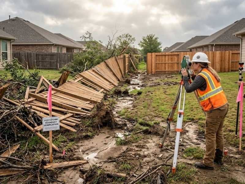
Getting a survey before you buy title insurance or construction insurance stops surprises during approval. This is especially important for vacant land that hasn’t been built on in many years. The longer land sits empty, the more likely boundary markers have disappeared or records have gotten unclear.
How Correct Property Measurements Stop Delays and Extra Costs
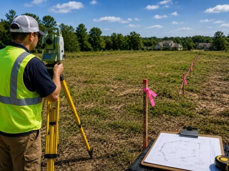
Contractors and engineers need accurate property data to give you real budgets and schedules. Guessing about property size or missing easement information leads to cost overruns and time delays.
When you hire an architect or engineer, they ask for a survey first. They need to know exactly where your boundaries sit and what easements or setbacks affect your land. With this information, they can design something that actually works and spot problems before building starts.
Engineers use survey data to plan grading and water runoff. If the survey shows low spots or drainage easements, they design around them. If the survey is missing or wrong, engineers guess. Wrong guesses mean redesigning and construction delays.
Contractors use surveys to find utilities under the ground before they dig. They place equipment and work areas based on your actual property lines. They plan the work schedule based on what the survey shows. Each piece of good information means fewer site problems and less wasted money.
Why Getting a Survey Early Protects Your Sale Price
Vacant land sells faster and for more money when it already has a current survey. Buyers and their banks view surveyed property as safer. The survey answers what they’re actually buying.
When you sell the property, buyers will ask if a recent survey exists. If yes, they move quickly. If no, they’ll require one as part of the sale, which delays closing and creates stress. Providing a survey removes this problem and often lets you charge more because you’ve removed a known cost for the buyer.
A survey also creates permanent proof of your property’s condition on a specific date. If a boundary dispute happens later, the survey provides evidence about what was true when you owned it. This protection stays valuable long after you sell.
Buyers also like surveys because they see exactly what land is usable and what’s restricted. They can see where setbacks apply, where easements limit building, and where the property is clear to use. This honesty builds buyer trust and speeds up negotiations.
Frequently Asked Questions
Does a survey change my property taxes?
No. A survey measures your property but doesn’t change your tax bill. Taxes are based on your deed and county records, not the survey. However, if a survey shows your land is smaller than your deed says, you might be able to ask the county to lower your taxes. The survey gives you proof if the difference is big enough.
Can I use an old survey from years ago?
Old surveys are usually still correct about where property lines sit because lines don’t move. But banks, insurance companies, and permit offices often want a survey no more than a few years old. An old survey might miss new easements, utility lines, or buildings that have appeared since then. For land being built on for the first time in years, a new survey is worth the cost.
What if my survey shows I own less land than the deed says?
Talk to whoever sold you the land or contact your title insurance company. If the boundary is very different from the deed, you might have a legal claim. The survey gives you proof. Title insurance sometimes covers these problems, depending on your policy and when the error started.
How does a survey help with building permits?
Most building permits need proof that your building will be far enough from the property line and won’t cross any easements. A survey shows this proof in a way permit officials accept. Without a survey, you have to get one as part of the permit process, which delays approval. Having a survey ready speeds things up.
Should I get a survey before I make an offer on land?
Yes. Get the survey after you make an offer but before you close. This lets you discover problems and renegotiate or back out if the land doesn’t work for your plans. Many purchase contracts let you cancel if the survey reveals big problems.