Surveying companies usually get the first call on a project. That call often comes before any equipment shows up. Builders who skip it tend to find out why it mattered later, once a problem surfaces that a quick check could have caught.
Why Builders Call Surveying Companies Before Site Work Starts
A builder’s schedule depends on accurate information from day one. Crews, equipment and material deliveries all get planned around a start date. That date assumes the site is ready for work. A surveying company confirms the details that make that assumption safe.
Without that early call, a builder works from assumptions instead of confirmed data. A missing detail rarely shows up on day one. It shows up mid project, when fixing it costs more time and money than catching it early would have.
Calling a surveying company before site work starts is less about paperwork and more about protecting the schedule. A short delay for confirmation beats a long delay for correction.
Property Lines Builders Need to Check First
Builders need to know exactly where a lot starts and ends before clearing equipment rolls in. This shapes where machinery can stage, where material piles can sit and how far clearing can extend without crossing the line.
A builder who clears or grades past the property line creates a costly problem. Work may need to stop. Soil or vegetation may need restoring, and the project timeline absorbs the delay. None of that happens when the lines are confirmed before equipment moves.
This matters even on lots that look straightforward. A property line rarely lines up exactly with a fence or an old marker. Builders who plan around the wrong reference end up redoing work that should have been right the first time.
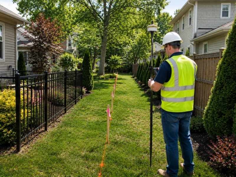
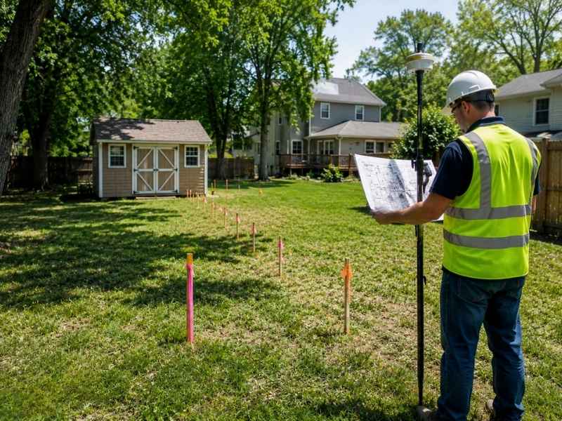
How Surveying Companies Mark Key Spots on a Job Site
Once the lines are confirmed, surveying companies place markers that guide the rest of the project. Corner stakes show where a building’s foundation should sit. Offset stakes give crews a reference point set back from the actual line, which keeps the marker intact during digging.
Driveways, utility runs and other site features get their own markers too. Each one tells a crew exactly where a feature belongs. Different trades working on the same site can all build toward the same plan.
These markers do the quiet work of keeping a project aligned. A foundation crew and a paving crew can show up on different days and still build to the same reference points.
Site Features Builders Need to Know About
Land rarely arrives flat and empty. A site review before work starts should account for:
- Hills or slopes that affect grading and drainage
- Ditches or low spots where water collects
- Existing fences that mark old boundaries
- Trees that may need to stay, move or come out
- Utility poles and lines that limit where equipment can operate
Missing any one of these can change how crews build the project. A slope that wasn’t accounted for changes a drainage plan. A utility pole in the wrong spot limits where a crane can work. Knowing about these features early means crews build the plan around them, not around a surprise.
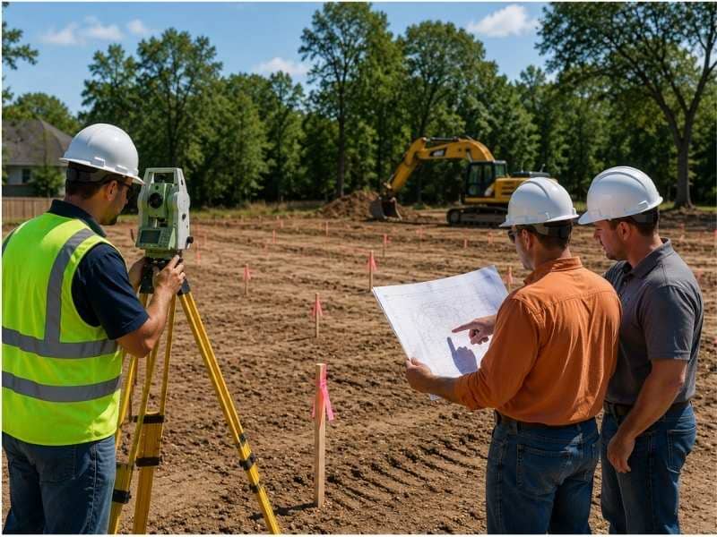
Why Good Measurements Help Keep Projects Moving
Every plan, schedule and budget on a job site rests on one assumption: the measurements behind it are right. When they are, crews move from one phase to the next without circling back to recheck something that should have been settled already.
When they aren’t, the cost shows up later. A foundation poured a few inches off the mark can force a redesign of everything built on top of it. A driveway laid out from the wrong point may need to be torn out and repositioned.
Accurate measurements from the start let a builder trust the schedule. Surveying companies don’t just confirm where things go. They protect the timeline everything else depends on.
Frequently Asked Questions
What do surveying companies do before site work starts?
A surveying company confirms property lines, marks key reference points and flags site features that could affect how a builder builds the project, all before equipment arrives.
Why are property lines important for builders?
Equipment staging, material storage and clearing all depend on knowing where a lot ends. Work that crosses the line can force costly corrections later.
How do surveying companies help builders?
They place markers that guide foundations, driveways and other features into the right spot, keeping every crew working from the same reference points.
What site features can affect construction?
Slopes, drainage ditches, fences, trees and utility poles can limit where equipment operates or change how crews grade and build a site.
When should builders contact surveying companies?
Before clearing land or scheduling site work. Confirming details early avoids the rework and delays that come from building on assumptions.